Unique Geological Features of Joshua Tree National Park: Exploring Rock Formations and Desert Wonders
Joshua Tree National Park is known for its remarkable rock formations, dramatic outcrops, and diverse geological landscape shaped by tectonic activity, volcanism, and erosion. These features set the park apart, creating a visual tapestry that attracts geologists, photographers, and outdoor enthusiasts alike. The park sits at the junction of the Mojave and Colorado Deserts, further enhancing its unique geology with a mix of elevations, climates, and rock types.

Massive boulders, weathered granite domes, and steep-sided rock piles rise abruptly from the desert floor, offering a glimpse into processes that began more than 100 million years ago. Many of these formations are not only scenic but also tell the story of ancient forces at work deep beneath the earth’s surface. For those interested in learning more, the intricate history of these formations is detailed on the National Park Service’s page about Joshua Tree's geologic formations.
Visitors can also observe features like desert varnish, which is more than 2,000 years old, and living soils that support unique desert life. These geological wonders make Joshua Tree an exceptional destination to explore the natural forces that continue to shape its landscape today.
Unique Geological Features of Joshua Tree National Park: Exploring Rock Formations and Desert Wonders
Geological History of Joshua Tree National Park
Joshua Tree National Park showcases a landscape shaped over millions of years by ancient geological processes and powerful natural forces. The park's distinctive rock formations, mountains, and desert plains have roots in both deep time and dynamic earth movements.
Formation of the Park's Landscape
Much of the rock seen in Joshua Tree dates back nearly two billion years, beginning with the formation of ancient metamorphic rocks. Later, about 100 million years ago, molten granite pushed up from deep inside the Earth, slowly cooling underground and solidifying.
Over time, weathering and erosion stripped away the softer layers above, revealing massive granite outcrops. The result is the park's iconic boulder piles, spires, and rugged hills. Soil in the region is also notable, as some areas host living soil crusts, adding to the ecological and geological diversity.
Ancient petroglyphs, carved into rock surfaces coated with desert varnish, indicate human presence at least 2,000 years ago. These features highlight how long the exposed rocks have been part of the landscape.
Tectonic Activity and Shaping Forces
Tectonic forces continue to impact Joshua Tree, as it sits near the meeting point of the Mojave and Colorado Deserts. Fault movements, uplift, and gradual shifts along nearby fault lines have uplifted and fractured the region's granite.
Freeze-thaw cycles cause cracks in these rocks to expand, breaking massive boulders into smaller formations seen today. Occasional rainfall, though rare, sculpts arroyos and fans as water moves sediment across the surface.
Erosion by wind and water gradually wears away at exposed surfaces, maintaining the sharp, unique shapes of the landscape. The landscape's active shaping continues, with geological processes both ancient and ongoing.
Iconic Rock Formations and Landmarks
Joshua Tree National Park features distinct geological formations shaped by millions of years of weathering, tectonic activity, and erosion. These rock landmarks stand out for their unusual shapes, accessibility, and geological significance within the desert environment.
Skull Rock: Erosion and Formation
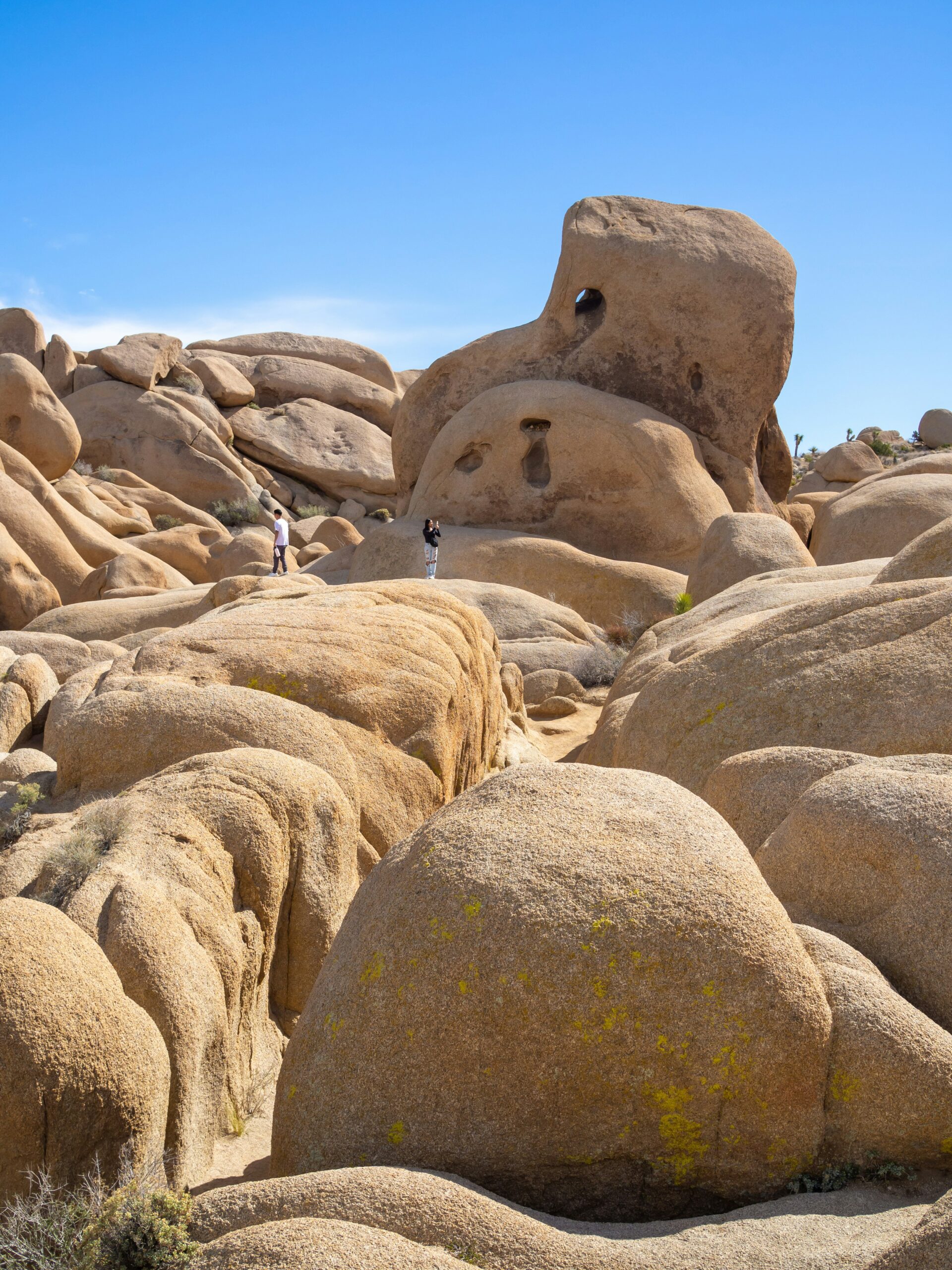
Skull Rock stands out due to its unmistakable resemblance to a human skull. Its unique appearance is the result of weathering processes, especially chemical weathering and erosional forces acting on monzogranite. Water pooled in depressions on the rock’s surface slowly eroded cavities, creating the “eye sockets” and hollow features seen today.
This formation is easily visible from Park Boulevard and offers a short, accessible walking trail. The rock’s surface appears pitted and rounded because the granite weathers unevenly, further accented by wind and occasional rain. Skull Rock is a top photo spot and a vivid example of how desert weathering can sculpt distinctive desert landforms.
Key Features
- Located near main park road
- Characteristic erosional features (“eye sockets”)
- Popular stop for visitors seeking unique photos
Arch Rock: Natural Stone Bridge
Arch Rock is a natural stone arch formed from the same monzogranite that gives much of the park its rugged look. The arch reaches about 30 feet across, shaped over time through a combination of mechanical and chemical weathering processes that hollowed out the weaker rock beneath the arch, leaving a freestanding natural bridge.
Visitors can access Arch Rock via a relatively short hiking trail. The arch is a prime example of how the park’s granite is prone to jointing and fracturing, which allows weathering agents to work along those weaknesses. Erosion then slowly carves out natural bridges and arches.
Notable Aspects
- Freestanding arch of granite
- Formed by jointing and erosion
- Popular for photography and exploration
Hidden Valley Boulders
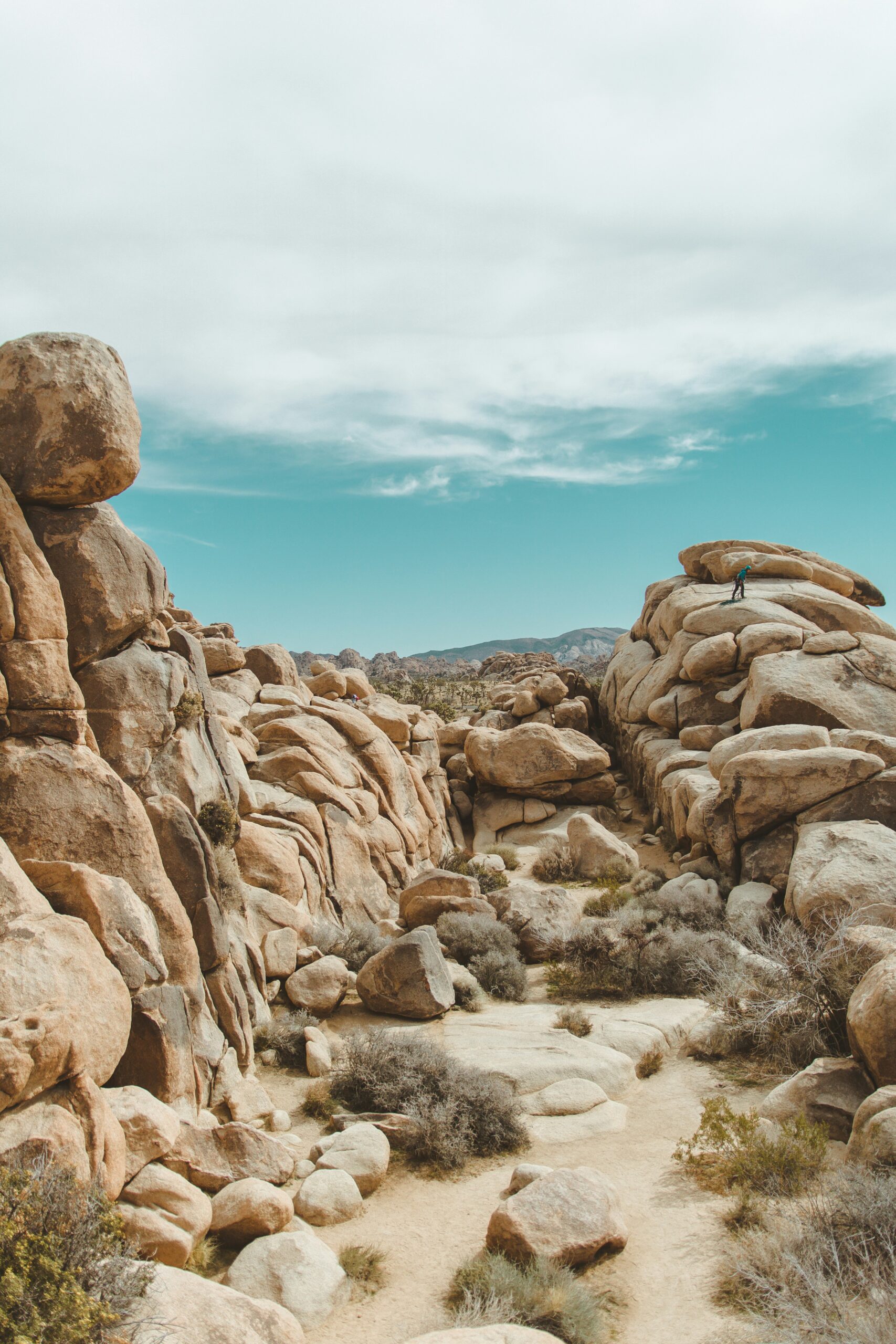
The Hidden Valley area is famous for its massive boulder piles and striking rock formations. These boulders form from large blocks of granite that fracture along natural joints, causing the pieces to separate and weather into smooth, rounded forms known as inselbergs. The result is a landscape of stacked rocks and boulder fields.
Hidden Valley is a hub for rock climbers and hikers. The area’s geology also helps create small pockets of fertile soil where desert plants thrive, contrasting with the open desert around it. These rock formations give the area a maze-like character and are a draw for both geology enthusiasts and outdoor adventurers.
Highlights
- Extensive boulder fields and inselbergs
- Important climbing and hiking destination
- Microhabitats for wildlife and desert plants
Distinctive Landforms and Geology
Joshua Tree National Park’s landscape reflects millions of years of tectonic activity, erosion, and weathering. Massive outcrops, sculpted rocks, and unique surface textures distinguish this region’s geology from other desert environments.
Monzogranite Outcrops
The park is famous for its vast exposures of monzogranite, an intrusive igneous rock formed underground over 85 million years ago. These outcrops owe their origin to magma solidifying beneath the surface, which much later became exposed through erosion.
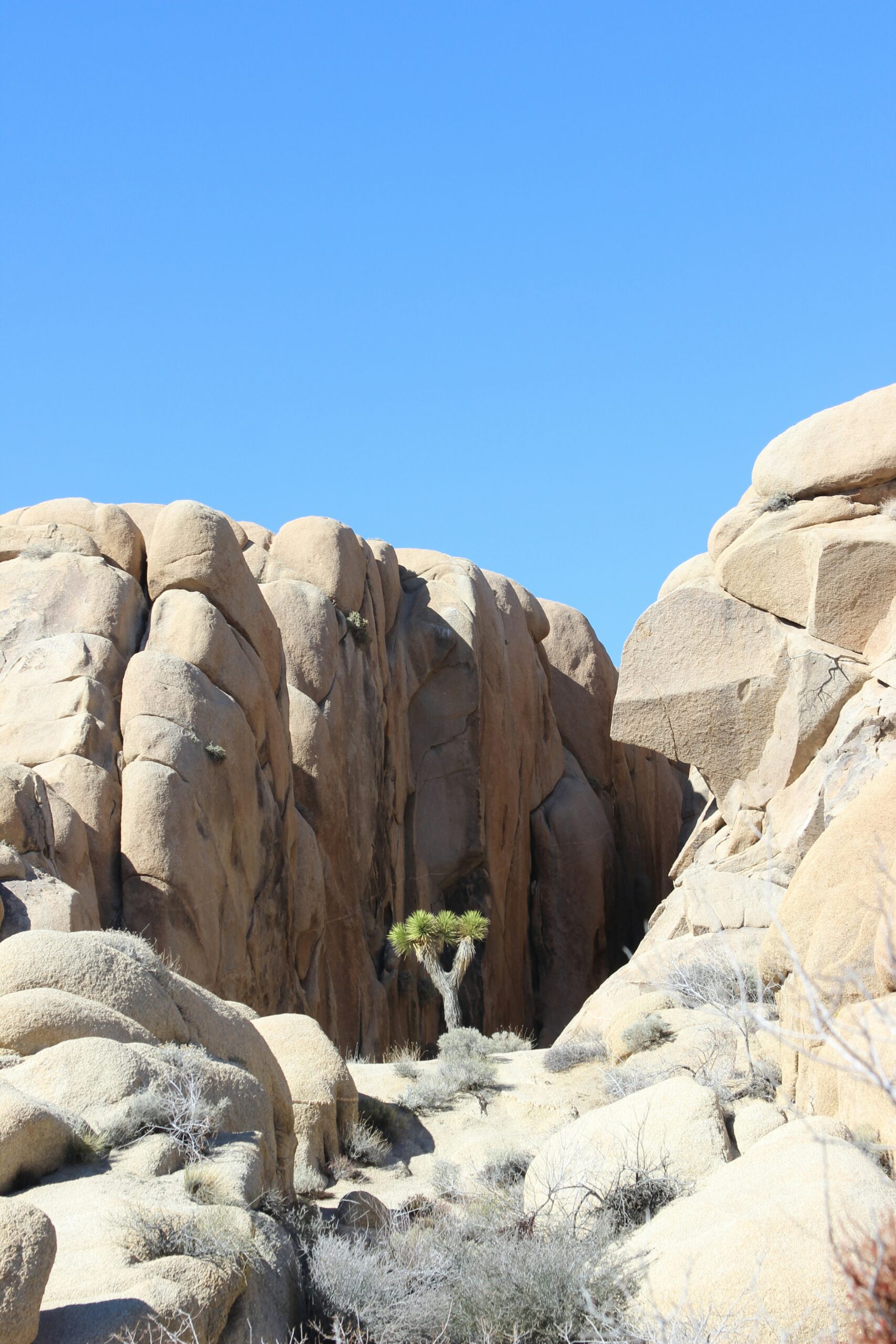
Monzogranite's coarse grain and light color make it recognizable. Joints and fractures appeared as the rock cooled and were gradually widened by water, ice, and wind. Over time, the surrounding softer materials eroded away, leaving behind the monzogranite features.
The resulting landscape includes rounded domes, walls, and boulders. These formations are particularly visible at sites like Intersection Rock and Hidden Valley. The durability and chemical stability of monzogranite explain its persistence across the arid region.
Tafoni and Weathering Patterns
Distinctive surface features called tafoni—small hollows or pits—form from a combination of mechanical and chemical weathering. Water infiltrates microfractures, dissolving minerals and initiating granular disintegration.
Cycles of moisture, salt crystallization, and temperature change enlarge these cavities. Over thousands of years, tafoni give the rocks their pitted or honeycombed appearance, particularly in shaded zones where moisture is retained longer.
Wind abrasion and biological activity, such as lichens, also contribute to these patterns. Tafoni and other weathering marks showcase the relentless forces shaping the park's geological character, as described in the USGS overview of Joshua Tree geology.
Granite Spires and Piles
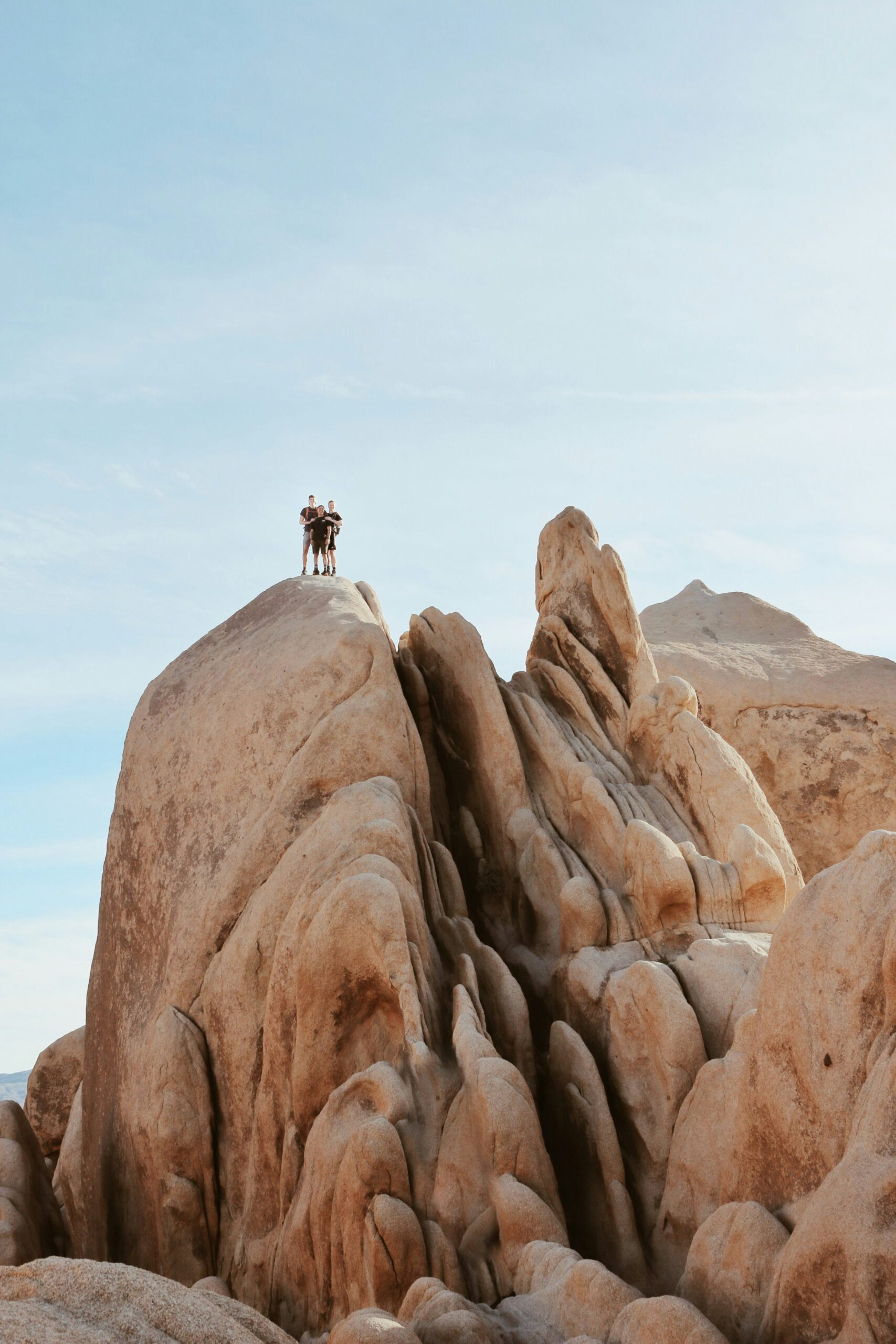
The disintegration of jointed granite creates dramatic spires and piles throughout the park. As fracturing progresses, blocks loosen and break free, accumulating in stacks that define much of Joshua Tree’s terrain.
Iconic formations like Skull Rock and Split Rock illustrate how differential weathering sculpts spires and balanced boulders. Vertical and horizontal cracks intersect, guiding the layout of piles and the emergence of freestanding towers.
These features attract rock climbers worldwide and are a visual highlight for visitors. The ongoing cycle of fracturing, gravity, and erosion ensures the landscape remains dynamic and ever-changing.
Unique Faults and Seismic Features
Joshua Tree National Park sits in a geologically active region where fault lines shape the landscape and impact its unique oases and rugged terrain. Two of the most significant features include a world-famous boundary fault and a notable internal fracture system.
San Andreas Fault Influence
The San Andreas Fault marks the southern boundary of Joshua Tree National Park. This fault is one of the most studied and recognizable geological features in California due to its potential for strong earthquakes.
From Keys View, visitors can directly witness the path of the San Andreas Fault as it stretches across the Coachella Valley. Its presence is more than a visual experience—this fault actively shapes the park’s southern borders through slow, continuous movement and occasional seismic jolts.
Key geological sites, like the palm oases, rely on groundwater that is forced to the surface along fault lines. This movement of water supports unique ecosystems within the desert, showing the interconnectedness of geology and biology in the park.
Emerson Fault Zone
Located more centrally in the park, the Emerson Fault Zone is notable for both its size and seismic activity. Unlike the San Andreas, this fault is internal to Joshua Tree and can be viewed from elevated locations such as the hilltop behind Lost Horse Mine.
The Emerson Fault Zone stands out for its history of producing significant earthquakes and its visible surface features, including offset rocks and distinctive landforms. These geological markers allow scientists and visitors to study the effects of past seismic events up close.
This fault also contributes to local water distribution, helping to sustain isolated oases and impacting soil formation in the area.
Noteworthy Geological Phenomena
Joshua Tree National Park’s landscape shows evidence of dynamic geological activity, including processes that create distinct surface patterns and landforms. Physical and chemical weathering, combined with unique desert conditions, shape many of the park’s most remarkable natural features.
Desert Pavement Formation
Desert pavement is a mosaic-like surface of closely packed stones that covers some areas of Joshua Tree National Park. This phenomenon forms over thousands of years through a process where wind and water gradually remove finer sediments, leaving behind larger rocks. These rocks become tightly interlocked, creating a durable, flat surface.
This surface affects local plant growth and water movement because it limits the amount of soil exposed to the elements. The stones absorb heat during the day and release it at night, influencing small-scale temperature variations. Scientific studies in the park help researchers understand how desert pavements develop and persist in arid environments.
Desert pavement is especially significant because it helps prevent further erosion in vulnerable desert soils. Its existence highlights the impact of ongoing weathering and sediment transport in shaping arid landscapes.
Alluvial Fans and Bajadas
Alluvial fans are cone-shaped deposits of gravel, sand, and silt that form at the base of mountains within the park. They develop when episodic flash floods carry sediments down rocky slopes, depositing them as the water flow slows at flatter terrain. Bajadas, in contrast, form when several neighboring alluvial fans merge to create a broad, sloping surface.
These features illustrate significant sediment transport from higher to lower elevations. They support sparse vegetation adapted to periodic flooding and rapid drainage. The patterns of alluvial fans and bajadas are especially evident in satellite images and provide a tangible record of past and present erosional processes.
In Joshua Tree, alluvial fans and bajadas are important for understanding groundwater recharge and the influence of climate on landform creation. Their structure and composition also affect where plants and wildlife can thrive within the harsh desert climate.


